
By Tony Kukulich
While beautiful weather is forecast for the Lowcountry’s first weekend of fall, the South Carolina Department of Natural Resources (SCDNR) is keeping a close eye on a tropical depression that is likely to develop into a Category 3 hurricane over the next few days.
The storm is expected to make landfall in Florida midweek. After that, its path is less certain.
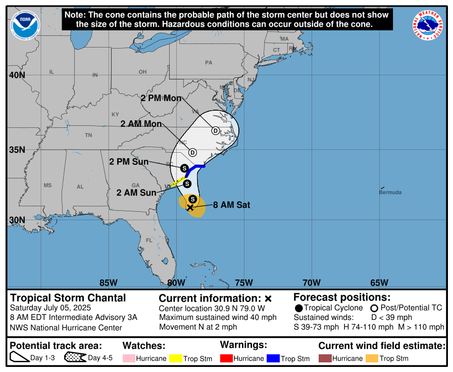
Dubbed Tropical Depression Nine, it is one of four tropical cyclones getting SCDNR’s attention as it has the potential to impact South Carolina late next week.
Frank Strait, severe weather liaison for SCDNR, said in his weekly report that Tropical Depression Nine doesn’t look like much now, but that is expected to change as it builds and strengthens in the coming days.
“The track over the waters south of Cuba is very concerning to me,” Strait said. “Not only is it so warm, but the warm water is present to a depth of hundreds of feet in this area. If it’s going to already be a hurricane once over this area, it could strengthen rapidly over these waters.”
The current track predicted for Tropical Depression Nine puts it north of Cuba by Tuesday morning. It’s then expected to make landfall on the southwest coast of Florida about 24 hours later as a Category 3 hurricane.
After making landfall in Florida, the predicted track for the storm becomes less clear. Changing conditions in the upper atmosphere along the East Coast will likely impact its path. A faster moving storm could move off the coast, while a slower moving storm could stall over the Carolinas and produce significant rainfall.
“Tropical Depression Nine presents risks to us late next week or next weekend, and you should prepare,” Strait said. “Have your kits fully stocked, especially if you live along our coast.”
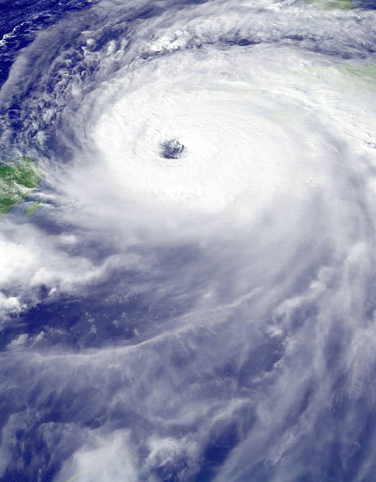
Among the other storm systems currently being tracked, Tropical Storm Gaston is near the Azores and presents no threat to South Carolina. Newly formed Tropical Depression Ten has emerged from West Africa and is expected to remain in the eastern Atlantic, also posing no threat to the state.
Hurricane Fiona passed by just west of Bermuda last night. Rough seas and surf are the only effects South Carolina will see from Fiona, and those diminish over the weekend. Beachgoers are urged to use caution as rip currents are likely to persist all weekend. For boaters, small craft advisories on coastal waters will expire Friday night.
There are four categories of tropical cyclones according to the National Oceanic and Atmospheric Administration, and they are delineated by the strength of their maximum sustained winds. A tropical depression is the weakest of the storms with maximum sustained winds of up to 38 mph, while tropical tropical storms have winds below 74 mph and hurricanes have winds of 74 mph and higher. A major hurricane has maximum sustained winds of 111 mph or higher.
Once a tropical depression develops into a tropical storm, it is assigned a name. The next tropical storm to develop will be named Hermine followed by Ian.
For more information on preparing for a hurricane, visit hurricane.sc.
Tony Kukulich is a recent transplant to the Lowcountry. A native of Wilmington, Del., he comes to The Island News from the San Francisco Bay Area where he spent seven years as a reporter and photographer for several publications. He can be reached at tony.theislandnews@gmail.com.