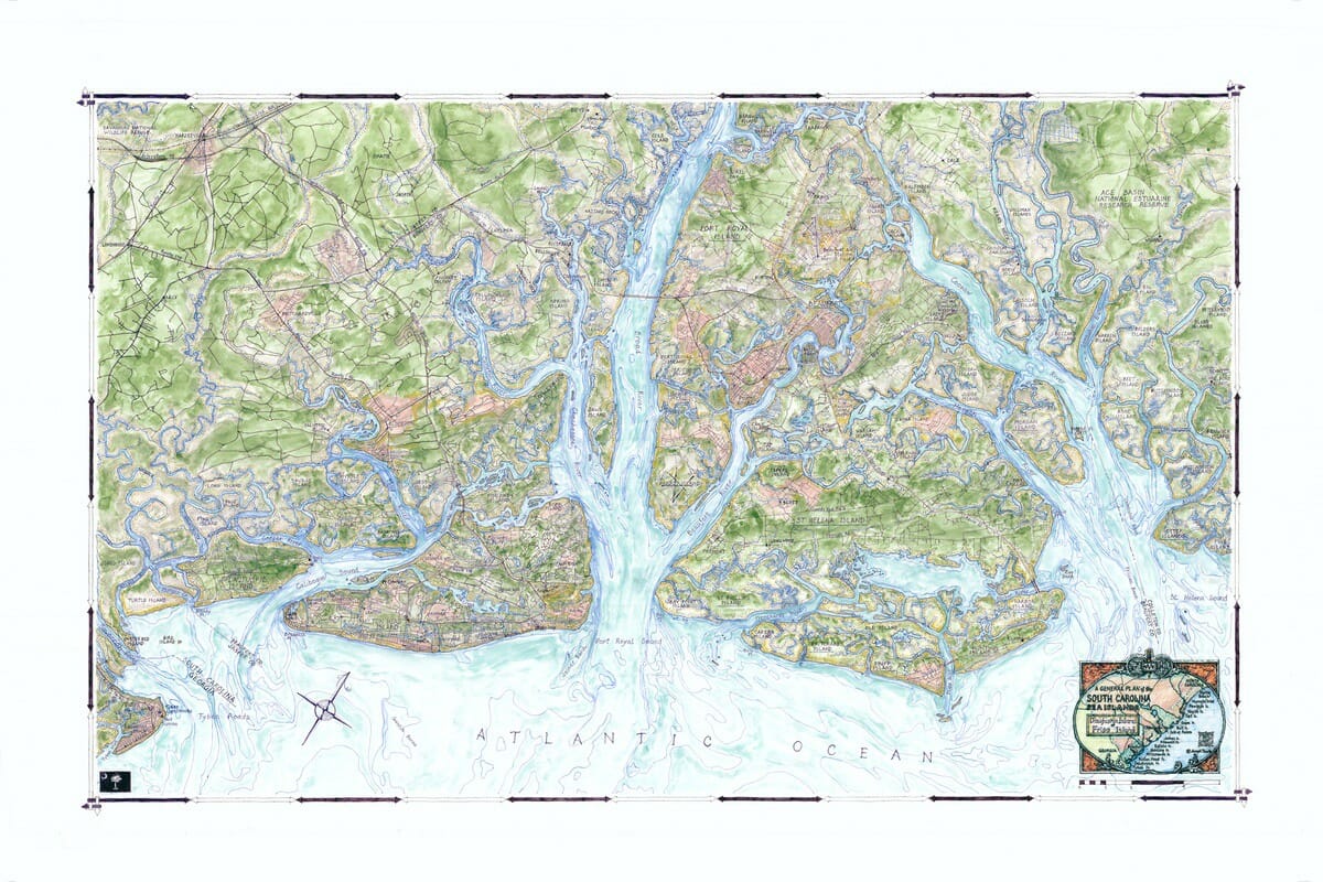
Coastal Art Maps, a company that captures the beauty of the East Coast shoreline through hand-drawn maps, has just released its “Sea Islands of South Carolina” map series, the latest additions to its collection.
These three new maps depict the beaches, towns and historic landmarks that span much of the 130 miles of the South Carolina coastline.
Joseph S. Tarella, a mapmaker at Coastal Art Maps, was able to spotlight the iconic historic towns, coastal attractions, islands and waterways along the South Carolina shore.
The first of the hand-drawn maps in the new collection, Daufuskie Island to Fripp Island, depicts the areas from the Georgia border, including Hilton Head, Port Royal, St. Helena, Fripp and Hunting islands and the city of Beaufort.
The map includes Hilton Head, Port Royal’s harbor and military bases.
A second map, Edisto Island to Isle of Palms, highlights areas including Charleston as well as Kiawah, Johns, James and Seabrook islands.
Finally, the third map, Capers Island to Cat Island, highlights Bulls, Murphy and Cape islands. This map portrays the settings steeped in history along the shore: classic plantations, white sandy beaches, rolling dunes, parks such as Francis Marion National Forest and marinas.
“It’s been a true pleasure capturing the beauty of the South Carolina shoreline, rich with history and resplendent against the backdrop of the extensive Lowcountry landscape. My ‘Sea Islands of South Carolina’’ collection showcases more than 100 miles of breathtaking South Carolina coastline, from historic cities like Charleston and Beaufort, to the wild, untamed islands of uninhabited beauty,” said artist Joseph S. Tarella, owner of Coastal Art Maps.
“South Carolina’s shoreline is picturesque and wonderfully diverse, and my new maps celebrate its beautiful beaches, idyllic harbor towns, sparkling marinas, as well as selective and sensitive development throughout these East Coast islands.”
For more information, visit www.coastalartmaps.com.


